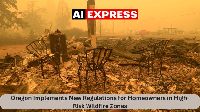
Portland, Oregon (Aiexpress) — Oregon residents who live in high-risk wildfire zones may face harsher building rules and demands to cut vegetation on their properties, according to new “wildfire hazard maps” released Tuesday.
The maps’ release comes after a record-breaking wildfire season last year and firestorms in 2020, which killed nine people and destroyed hundreds of homes.
According to Oregon law, the state-developed maps will have no effect on homeowners’ insurance rates. They impose new regulations for those who live in the most fire-prone areas that also border wildlands such as woods or grasslands. The restrictions affect 6% of the state’s approximately 1.9 million tax lots, down from an earlier version drafted in 2022 but withdrawn when residents expressed fears that it would boost insurance costs.
Climate change is making wildfire seasons longer and more intense, and Oregon isn’t the only state trying to figure out how to control the danger. Washington and Colorado have also recently taken steps to reduce fire danger in their towns, and a new law introduced in California last week would compel insurance companies to provide coverage in high-risk wildfire zones in order to continue doing business in the state.
In Oregon, the new building and so-called defensible space standards will only effect approximately 106,000 tax parcels. According to Mark Peterson, spokesperson for the state department overseeing the Building Codes Division, the building codes will require fire-resistant features in new construction in high-hazard areas of the wildland-urban interface, but will only apply to existing homes if people make certain upgrades, such as fully replacing a roof or siding.
Experts say the maps are a vital step in identifying and safeguarding fire-prone regions as the state battles record-breaking wildfires. Since 2020, blazes have destroyed residences on the Oregon coast, close inland from the Pacific Ocean, in regions previously assumed to be fireproof due to a wetter, colder environment.
“After 2020, we can’t pretend anymore that this is just an issue for southwest and central Oregon,” Andy McEvoy, a faculty research assistant at Oregon State University’s College of Forestry who worked on the map, told the Associated Press. “All of those events really cried out for a statewide — a truly statewide — strategy to respond to wildfire risk.”
Wind-fueled fires over Labor Day weekend in 2020 were among the greatest natural disasters in state history, killing nine people, destroying thousands of homes and other structures, and consuming more than 1,875 square miles (4,860 square kilometers).
The 2024 wildfire season was likewise historic. It cost Oregon more than $350 million, making it the most expensive on record, and it burnt a record 3,000 square miles (7,770 square kilometers), primarily on range and grazing property in the state’s rural east.
According to McEvoy, the maps will assist officials in assisting towns that require the most wildfire assistance. Reducing vegetation around homes to create a buffer zone of defensible space, as well as installing fire-resistant elements like metal roofs or fiber cement siding, can improve a home’s fire resistance.
“If we manage our vegetation a certain way, if we build our structures out of certain materials, then we can increase the likelihood of that structure surviving,” he told me. “But we’re not going to change the probability of the fire occurring in the first place.”
The Oregon Department of Forestry issued two maps depicting wildfire hazard levels and the wildland-urban interface, created by Oregon State University experts.
A state legislation passed in 2023 prohibits insurers from canceling or declining to renew a homeowner insurance coverage based on a wildfire hazard map provided by a state agency, or from increasing prices. However, McEvoy pointed out that most insurers have been working on their own wildfire risk models for a long time.
“There’s very little in this map that hasn’t been illustrated or represented in other products produced by researchers or the insurance community themselves,” according to him.
Oregon fire authorities and experts revised the initial wildfire hazard maps after receiving thousands of public comments and hosting public forums across the state. McEvoy stated that significant modifications included lowering the hazard status of irrigated farms, as well as hay and grazing fields. The latter are frequently watered during haying and grazed for much of the fire season, reducing vegetative fuels on the terrain.
Wildfire hazard maps have been in place in California, Arizona, and New Mexico for several years. Last year, Washington lawmakers ordered the building of a statewide wildfire risk map, and in 2023, Colorado passed legislation establishing a wildfire resiliency code board.
The adoption process for the defensible space regulations, which will be administered by the Office of the State Fire Marshal, and the building codes, which will be handled by the Building regulations Division, will not begin until the wildfire danger maps’ appeals period has ended. The Oregon Department of Forestry will notify the owners of affected tax parcels.


Leave a Reply