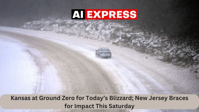
Aiexpress – An all-out snowstorm is already affecting Kansas, and another blizzard may hit New Jersey and parts of the east coast next weekend.
A major winter storm will move eastward from the Central Plains into the Ohio Valley and Mid-Atlantic tonight, bringing snow, sleet, freezing rain, and strong winds with it. Blizzard conditions will persist from Kansas into northwestern Missouri this evening, with conditions improving from west to east overnight. Heavy snow will move eastward over the Ohio Valley and central Appalachians tonight, reaching the Mid-Atlantic by Monday morning. While winds will be weaker in the Ohio Valley and Mid-Atlantic region, gusts of up to 20-25 mph are still likely, resulting in poor visibility due to snowfall or snow on the ground.
Snowfall accumulations of 6-12 inches are forecast from southern Ohio to the D.C. metropolitan region, with lower amounts in the north. New York City is expected to have little to no accumulation. Sleet and freezing rain are forecast south of the snow, with dangerous ice accumulations exceeding 0.25 inches in northern Kentucky and southern West Virginia. Ice accumulations of 0.10-0.25 inches are forecast east of the Blue Ridge Mountains in western North Carolina and central/southern Virginia.
On the warm side of the storm system, severe thunderstorms capable of producing tornadoes and devastating straight line winds will move eastward from Arkansas and Louisiana into Mississippi and Alabama this evening. The chance of severe thunderstorms is forecast to decrease overnight before increasing again for sections of southern Georgia and northern Florida on Monday, while the hazard is expected to be lower than in the Lower Mississippi Valley.
The eastern storm system will quickly reach the western Atlantic Monday night, leaving lingering snow showers downwind of the Great Lakes and in the preferred upslope regions of the central/northern Appalachians. Much colder air will enter the central and eastern United States in the aftermath of the eastern storm system, resulting in maximum temperature deviations of 10 to 20 degrees below average for vast sections of the Great Plains to the East Coast on Monday and Tuesday.
This influx of cold air will pave the way for a new storm system to build later in the week. Meteorologists’ forecast models have suggested that a storm system may erupt into a “blizzard bomb” and bring heavy snow whipped by strong winds to parts of the northeast.
While the phrase “blizzard bomb” may sound like meteorological hyperbole, the concepts have scientific definitions. The storm system responsible for the blizzard bomb will be just that: an area of low pressure caused by a meteorological “bomb,” with blizzard criteria predicted to be met across a wide area. A “bombing” low pressure system fits the conditions for a quickly deepening low pressure system; pressure must decrease by at least 24 mb in 24 hours to be classified “bombing.”
Many people believe that a blizzard is merely a large snowstorm. This is incorrect. Blizzards are all about wind and visibility. The National Weather Service defines a blizzard as a storm that meets three conditions. First, there must be sustained winds of 35 mph or frequent gusts over 35 mph. Second, due to the weather, visibility should be decreased to 1/4 mile or less. This decline might occur due to severe snowfall or wind-blown snow. Fresh snow is not required to meet blizzard conditions. Third, for it to be considered a blizzard, the reduced visibility and severe gusts must endure at least three hours. When all three requirements are met, you have a blizzard, not just a snowstorm!
Meteorologists employ a variety of computer models, including the GFS and ECMWF, to aid with weather forecasting. While meteorologists have various tools at their disposal for creating weather forecasts, they primarily use two global forecast models: the ECMWF from Europe and the GFS from the United States. While the models use much of the same beginning data, they differ in how they digest it and calculate alternative outcomes. In certain cases, one is superior to the other, while in others, the opposite is true. No model is always “right”. In addition to the ECMWF and GFS models, various more models from other countries, academic organizations, and private business are used to provide forecasts.
Right present, both of these global models predict an east coast storm forming. The majority of recent GFS runs still predict a blizzard or bomb blizzard, although the ECMWF is substantially weaker. Which one will be correct is anyone’s guess for the time being; it is just too early to predict how this next storm will play out until the current storm in the United States passes.


Leave a Reply