Severe weather is expected to affect a staggering 70 million Americans from the Northeast on Sunday, extending through Tuesday in the Midwest.
The multi-region storm system has been designated an enhanced risk outlook by NOAA’s Storm Prediction Center, indicating a level 3 out of 5 risk for severe weather.
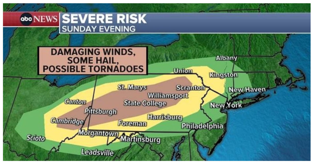
Intense thunderstorms are expected to form during the late afternoon on Sunday in the Northeast. This will occur along a path stretching from the upper Ohio Valley to the Pocono Mountains in Pennsylvania and the Catskill region in Upstate New York.
As the storm continues to move southward into Sunday evening, there is a possibility of damaging wind, hail, and even tornadoes.
A line of strong to potentially severe storms is expected to affect cities from Pittsburgh to New York on Sunday night, between 10:00 p.m. ET and 11:00 p.m. ET.
A powerful weather system is expected to sweep across the Rockies and into the Great Plains, spanning from the Dakotas to Texas, in the Midwest on Monday. This dynamic system has the potential to generate severe storms, including supercells, which could bring about significant hail, destructive winds, and even tornadoes.
Severe thunderstorms are expected to be scattered across the southern to central Great Plains, primarily on Monday evening. During this time, there is a possibility of large hail, damaging winds, and a few tornadoes.
Severe weather is expected to start as early as 5:00 p.m. CT from Central Texas to Nebraska, with storms continuing to develop overnight across the region.
Tuesday morning is expected to bring storms to eastern Nebraska, Kansas City, Missouri, and parts of Iowa. These storms may retain their strength and pose a potential threat.
Expect the most powerful storms to occur in the region stretching from Des Moines, Iowa, to Columbia, Missouri, during Tuesday afternoon.
On Tuesday, there is a high chance of scattered severe thunderstorms occurring from Chicago to east of Dallas, lasting into the evening.
Wednesday morning could still see the presence of powerful and potentially destructive storms in the Ohio River Valley.
