Across the Oregon Area:
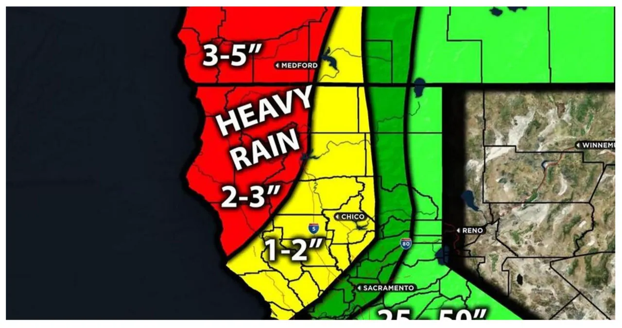
Aiexpress – Rain showers and primarily mountain snow are expected to move through the region as the system approaches. There is also a possibility of snowfall in lower elevations, as mentioned earlier. The coastal regions of Oregon can anticipate heavy rain at times. After the front passes, cold air aloft and elevated instability will result in widespread showers and thunderstorms on Monday. These storms have the potential to produce hail or graupel across the entire region west of the mountains. You can refer to the maps below for information on rainfall, snowfall, and potential wind gusts. For more detailed forecast information, please check the overall forecast.
Overall Forecast:
A trough is forecasted to approach the upper levels of the atmosphere over Portland, dipping down off the coast, while a cold front is expected to sweep through from the northwest to the southeast. This will result in colder air moving in starting Sunday night, leading to cooler temperatures throughout the week. Mountain areas such as the Cascades and nearby hills above 1000 feet have a high probability of experiencing snow. With significant moisture incoming, there is a possibility of substantial snow accumulation, particularly in the mountains, where some areas could receive over a foot of snow. Residents living in the Coast Range or Willapa Hills above 1000 feet should anticipate 2-5 inches of snow early on. Additionally, strong winds may cause reduced visibility due to blowing snow.
Monday will bring intermittent rain and snow for those above 1000 feet. As the day progresses, the weather may turn stormy, with the possibility of thunderstorms even in lower areas. These storms could bring small hail or graupel, a type of soft hail. As Monday night approaches, the risk of storm development will decrease as more stable air moves in. Tuesday will see a transition from snow to rain showers, some of which may be heavy at times. For the hourly forecast and more specific timing details, please refer below.
Timing & Impact: On Saturday night, as the system moves in, the region can expect rain showers, with mainly mountain snow. As discussed earlier, there is also the potential for snowfall at lower elevations. The rain will be particularly heavy, especially in coastal areas of Oregon. Following the front, on Monday, there will be widespread showers and thunderstorms across the entire region west of the mountains. These storms will have elevated instability and may produce hail or grapple. On Tuesday, snow is expected before transitioning to rain in the morning, with snow levels rising to 1500 feet higher. Please refer to the maps below for information on rainfall, snowfall, and potential wind gusts.
