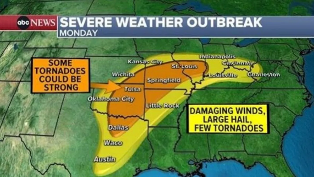
The Heartland and Midwest are bracing for severe weather, which could bring about damaging winds, large hail, and a few strong tornadoes.
Severe thunderstorms are forecasted for Monday, spanning from Texas to West Virginia. The highest risk of tornadoes is anticipated in the area stretching from Oklahoma to Missouri.
Tornadoes are also possible in the Ohio River Valley, specifically from Louisville, Kentucky, to Cincinnati. However, the likelihood of tornadoes in this area is not as significant as in other regions.
As the storm progresses towards the east, the severe weather is expected to intensify, particularly in the regions spanning from Mississippi to West Virginia. The states at highest risk of tornadoes include Tennessee and Kentucky.
A flood watch has been issued from Indiana to Maryland, with the potential for some areas to receive up to 5 inches of rain in the coming days.
A portion of that rainfall will subsequently overflow into the other regions of the Northeast.
The Interstate 95 corridor, spanning from Philadelphia to New York City to Boston, can expect the heaviest rainfall on Wednesday. There is a possibility of flash flooding in this area.
Snow is expected in Indianapolis, Chicago, and Green Bay, Wisconsin by Wednesday.
Snow is expected to arrive in inland Pennsylvania, upstate New York, and New England on Wednesday evening. There is a possibility of receiving over 1 foot of snow in the northern Great Lakes region and the New England mountains by Thursday.
