Today, there are plenty of clouds in the sky, and there is a chance of a few flurries here and there.
However, it is worth noting that we are currently experiencing the warmest air of the week so far. Despite the presence of some bothersome snowflakes, there is no room for complaints.
It is important to exercise caution while driving this morning, particularly in the northern regions where slick spots may be present. If any sun manages to peek through the clouds today, consider it a bonus.
Late tonight and tomorrow, a clipper system is approaching. We anticipate a snowfall of around one to two inches across Ohio, with an estimated coverage of 80%. This system will move swiftly, and we can anticipate the clouds to dissipate by late afternoon.
However, accompanying this system are frigid temperatures making a comeback. Tomorrow, temperatures will drop below the usual average, and this cold spell will persist throughout the weekend.
Although not as severe as earlier this week, it will still be quite chilly. We will have to endure these conditions for another three days before the weather pattern shifts.
Next week will bring much warmer temperatures, with Monday seeing temperatures above normal as clouds begin to increase. As we move into Tuesday through Friday, we can expect two waves of moisture to approach.
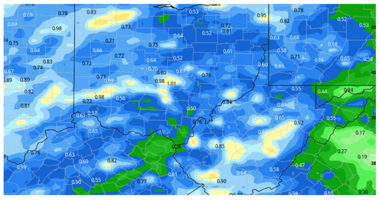
These combined waves will result in rainfall ranging from .25″ to 1″, covering approximately 80% of the state. Take a look at the map below to get an idea of what we can expect.
Next weekend will bring mild weather with occasional breaks of sun. However, it will be quite messy due to a combination of rainfall from the previous week and the rapid melting of frozen moisture.
