Aiexpress – The southwesterly flow will persist until the end of the week, bringing with it another bout of fog and freezing rain on Wednesday and Thursday. Please see the information below for further details.
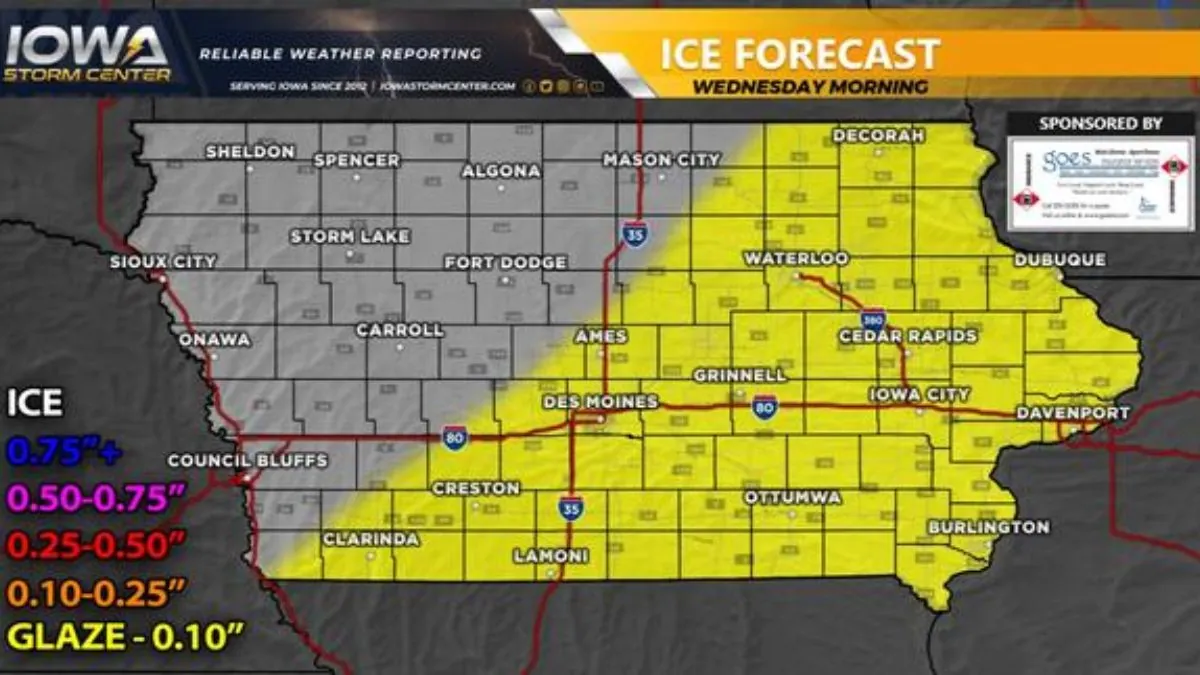
Fog is expected to redevelop in most areas of the forecast region later tonight through Wednesday morning. The fog is likely to dissipate by late Wednesday morning, except for central Iowa. Recent soundings indicate the presence of light moisture in the mid-levels and near the surface across northwest and north central Iowa during this time, which could lead to freezing drizzle and a light glazing of ice. Meanwhile, the main event will impact the southeastern parts of the region, with freezing rain moving in after midnight tonight and continuing northward into central Iowa by Wednesday morning. As temperatures rise later on Wednesday morning, areas further south can expect the freezing rain to transition into regular rain. However, conditions may still be hazardous, with a total ice accumulation of up to a glaze-0.10″. All precipitation is expected to clear out by early Wednesday afternoon.
A final round of moisture is expected to move through the forecast area late Wednesday night into Thursday. This round will follow a similar path to the previous one, increasing the risk of freezing drizzle across most zones. I am currently analyzing this event, and the ice numbers will be provided in the upcoming final report. The system is expected to move east of the forecast area by Thursday afternoon.
Long Range:
A split flow is expected to result in below average precipitation from Friday through late next week. However, the active stream of moisture is forecasted to return by the first full week of February. Stay tuned for more articles on this topic in the coming weeks.
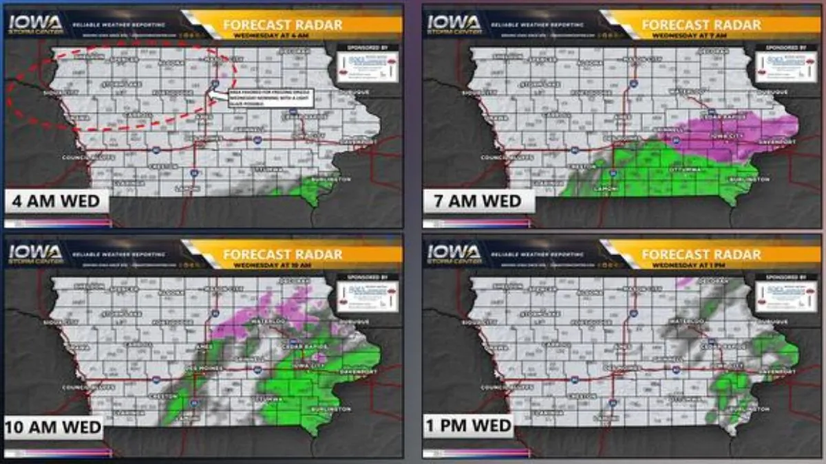
Forecast Radar:
Ice Forecast –