The Southern Plains and Lower Midwest Experience
A dangerous setup for ice is expected to unfold tonight through Monday morning across the southern plains and through the lower Midwest. This is due to the same mid/upper trough with a negative titled axes, which is expected to bring more issues across a majority of states. As a result, icy roads and hazardous conditions are likely to occur. Here are more details for the forecast, including regional information.
Overall Forecast:
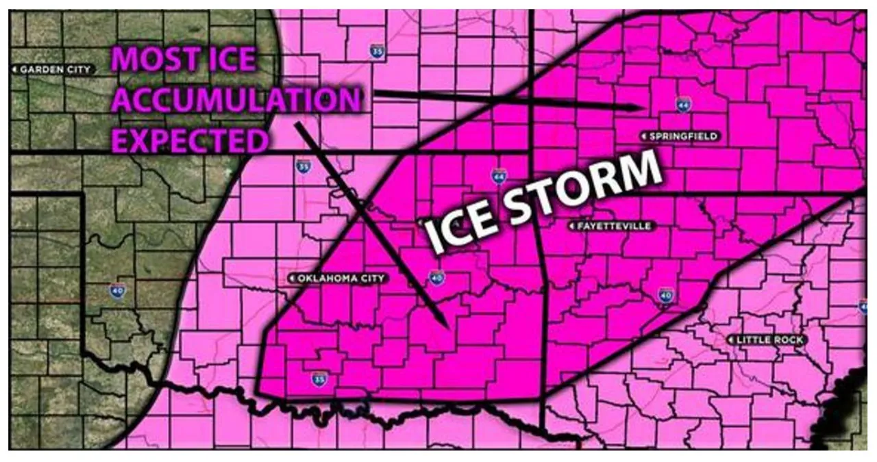
In the south-central U.S., a trough with a negative tilt is projected to advance eastward through the mid/upper levels of the atmosphere. This weather system will result in the influx of abundant Gulf moisture into the central part of the country. Already, dew points are on the rise as the moisture makes its way into the region. However, the varying temperatures in the atmosphere, coupled with a notable warming trend at around 850mb, will cause frozen precipitation to melt before reaching the ground as rain. Subsequently, it will refreeze at the surface level, creating ideal conditions for the formation of ice.
Timing & Impact: Freezing rain will occur in parts of northern Texas, Oklahoma, Kansas, Missouri, and Arkansas. It will begin this evening in northern Texas and central Oklahoma, then move north-northeast across the region by Monday morning. Upon contact with the ground, the rain will freeze immediately, resulting in icy conditions. The highest accumulation of ice is expected in Missouri, Arkansas, and Oklahoma, with over a quarter of an inch of ice possibly accumulating, which will create extremely dangerous conditions. As temperatures rise, the freezing rain will transition into heavy rain throughout Monday.
Read More:
- The Border, Crime, and Economy: Five Senate Candidates Express Their Positions
- Let’s Talk About California’s Funky Smelling Drinking Water
