The weather conditions for extreme southwestern California, which includes Orange, San Diego, western Riverside, and southwestern San Bernardino counties, have been updated by the National Weather Service.
At present, low clouds from the marine layer are extending into the valleys, and the marine inversion is situated at approximately 1,000 ft MSL.
Based on the latest surface observations, the marine layer has already deepened by several hundred feet.
The region is currently seeing some scattered high clouds and light winds. According to the forecast, the west winds in the mountains and deserts are expected to strengthen tonight and continue into Wednesday. However, these winds are not anticipated to reach advisory levels, despite their increasing intensity.
On Wednesday, Southern California can expect stronger onshore flow due to the arrival of a compact shortwave moving into the Pacific Northwest.
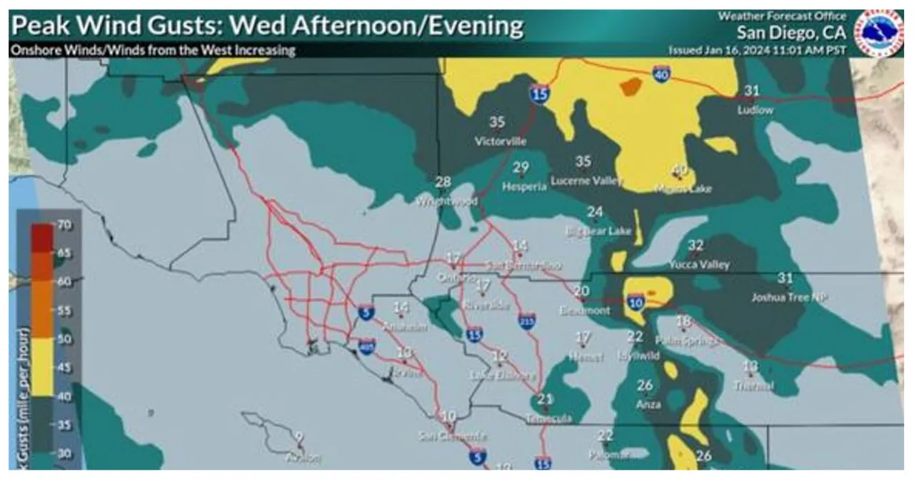
Expect gusty winds in the mountains and deserts during the afternoon and evening hours, with peak wind gusts reaching speeds of 40-50 mph.
On Wednesday night and into Thursday, there will be a deepening marine layer and a weak shortwave passing through. This weather system brings with it a slight chance of rain to areas west of the mountains. However, it is expected that the rain will be very light, and most areas will likely remain dry.
On Thursday, temperatures across the western United States will rise 2-5 degrees above the usual seasonal averages as the upper low merges with the mean flow and ridging develops. However, on Friday, the warming trend will be constrained by the arrival of high clouds associated with the upcoming system, keeping temperatures at seasonal levels.
The weekend is expected to bring a significant pattern change, with longwave troughing across the western United States. Multiple shortwaves are anticipated, which could result in lighter and more scattered precipitation on both Saturday and Sunday.
The weather forecast indicates that a significant amount of precipitation is expected on either Monday or Tuesday. Early estimates suggest that the coast and valleys could receive over 1 inch of rainfall, while the mountains may see several inches. It is anticipated that the snow levels will remain above 7000 feet for most of the event.
The deep trough is forecasted to push southeastward by the middle of next week, while a ridge will form across the eastern Pacific.
