A powerful winter storm, causing blizzard conditions, moved through the Plains and upper Midwest. The storm brought heavy snow, freezing rain, and strong winds, making travel hazardous during the busy holiday week.
The National Weather Service said that the storm’s powerful wind gusts on Monday and Tuesday, reaching speeds of 50 to 60 mph and occasionally reaching up to 75 mph, created blizzard conditions and made travel extremely challenging.
Blizzard warnings were in effect on Monday and Tuesday in parts of Nebraska, South Dakota, Kansas, Colorado, and Wyoming. Blizzards are characterized by blowing snow and strong winds that persist for at least three hours, resulting in visibility reduced to a quarter-mile or less.
Tuesday evening saw the closure of a significant portion of highway in western Nebraska due to extremely low visibility levels. The Nebraska State Patrol announced that westbound Interstate 80 and Highway 30 were shut down from Lexington to the Colorado and Wyoming state lines, covering a distance of over 200 miles. This decision was made in light of hazardous travel conditions and the limited availability of services in many areas. Furthermore, eastbound travel on these highways was also closed from Wyoming to North Platte, spanning approximately 179 miles.
South Dakota experienced heavy snowfall, with some areas receiving over a foot of snow. The National Weather Service reported that Gregory received 13.8 inches, while Deadwood and Spearfish got 12 inches. In addition, Aurora, Colorado, received 7.5 inches of snow, and Norfolk, Nebraska, got 7 inches, as confirmed by the service.
The weather service issued a warning of widespread travel disruptions in the region. Residents were advised to avoid travel if possible. However, if they needed to be on the road, they were urged to bring survival kits and stay in their vehicles in case they become stranded.
Blizzard warnings and ice storm warnings were set to expire across the Central and Northern Plains on Tuesday night to Wednesday morning. Some areas in the region may still experience light to moderate snow, as well as rain and freezing rain, until early Wednesday morning.
The snowfall in the Midwest is expected to come to an end by the end of the day on Wednesday. Similarly, the freezing rain in the Northern Plains will also cease. Additionally, the threats of excessive rainfall in the Appalachian Mountains will subside.
On Wednesday, there is a potential for heavy rainfall in certain areas along the I-95 corridor of the northern Mid-Atlantic and the Northeast. This poses a marginal risk, or level 1 out of 4, for excessive rainfall. Cities such as Washington, DC; Philadelphia; and New York City are particularly at risk for flooding. As a result, there may be travel and flight delays in these major Northeast cities on Wednesday.
While traveling from Denver to Chicago on Tuesday, Bradley Sanders found himself caught in the blizzard. Sensibly, he decided to pull over near Ogallala, Nebraska around noon to charge his car. However, he soon discovered that the highway was closed due to the severe weather conditions. Consequently, he had no choice but to book a motel for the night. At the motel, he encountered a long line of stranded drivers desperately seeking a room.
Amanda Dawn Benitez, who was also stranded in Ogallala, shared her experience with CNN on Tuesday. Benitez, her husband, son, and their 2-pound chihuahua were traveling from Twin Falls, Idaho, to McDonough, Georgia in her husband’s 18-wheeler. They had planned to spend Tuesday night in Ogallala due to the weather conditions. Benitez, who is from Alabama, expressed that she has never seen so much snow in her life.
“I asked for a white Christmas, but I didn’t expect a blizzard,” she remarked. Benitez mentioned that her son and chihuahua are currently having a great time playing in the snow.
On Tuesday, in certain regions, the primary winter weather hazard transitioned from snow to ice.
A combination of sleet and freezing rain is posing a risk of power outages and treacherously icy conditions on roads and sidewalks in certain areas of the northern Plains and upper Midwest today. Ice storm warnings are in effect for portions of the Dakotas and Minnesota until this evening.
The North Dakota Department of Transportation has issued a travel advisory for residents in 14 counties, urging them to avoid traveling on Tuesday due to hazardous winter road conditions. Additionally, westbound lanes of approximately 50 miles of Interstate 94 have been closed this morning as a result of several traffic incidents. Stay safe and stay off the roads if possible.
According to the service, freezing rain from ice storms was reported in the Dakotas on Tuesday. Verona, North Dakota received an inch of freezing rain.
The storm is forecasted to gradually weaken on Tuesday night in the central US and will significantly lose its strength by early Wednesday. Although there may be a few lingering snow showers or a mixture of rain and wet snow in the Plains, the widespread and disruptive weather is expected to come to an end by midweek.
Accidents and road closures began on Christmas Day
Treacherous conditions swept through the central US on Monday as the storm unleashed a hazardous combination of snow, ice, and powerful winds.
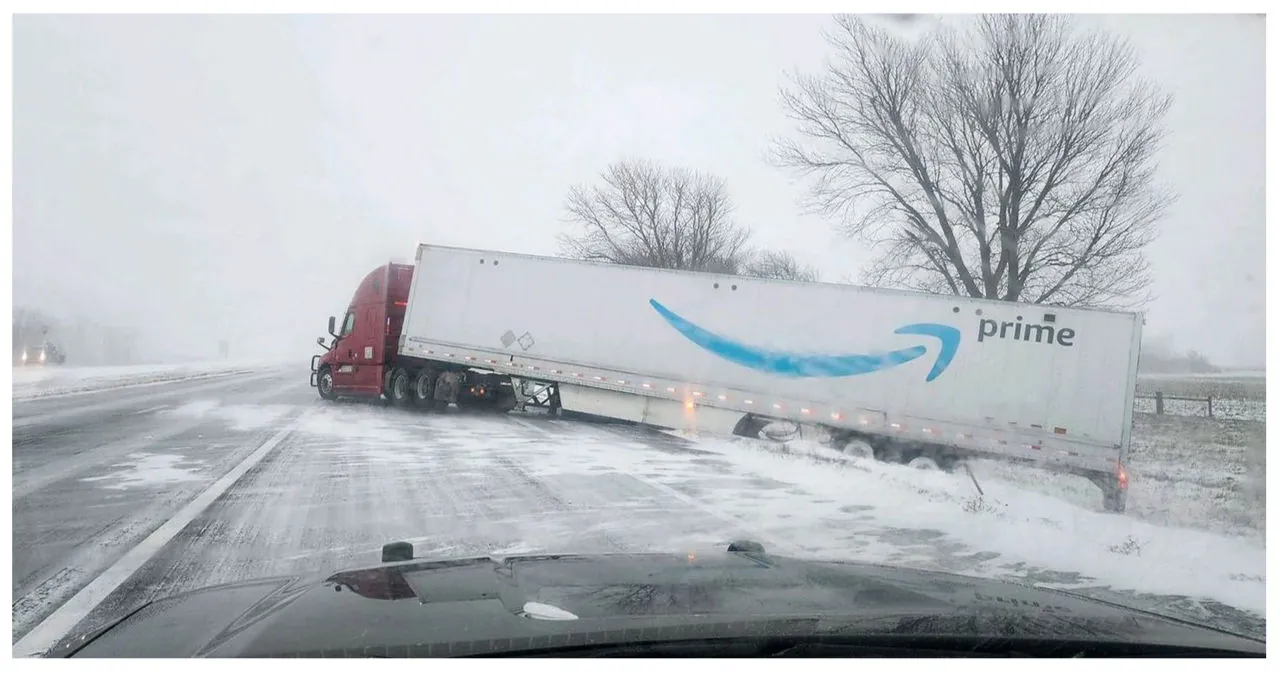
On Monday, multiple cars collided and slid off roads in Nebraska. The Nebraska State Patrol reported that tractor-trailers jackknifed and became stuck on eastbound Interstate 80 near York during the morning and early afternoon.
Heavy snowfall hit the Dakotas, causing significant disruptions. In South Dakota, the South Dakota Department of Transportation reported the closure of I-90 in both directions. This closure extended over a distance of more than 200 miles between Mitchell and Wall. The closure lasted from Monday night until Tuesday morning.
The Department announced that the eastbound lanes between Wall and Rapid City, covering a distance of approximately 50 miles, were closed. As for the westbound lanes, they were expected to stay open on Tuesday, unless there were any changes in weather and road conditions.
The Department has advised motorists against using secondary highways as an alternative to the Interstate closures. They have emphasized that travel during this storm system will be extremely dangerous due to significantly reduced visibilities and blizzard-like conditions.
The South Dakota Highway Patrol reported multiple crashes in Watertown due to the accumulation of ice and snow on the roads.
The South Dakota Highway Patrol has issued an important reminder to residents: “Please slow down, refrain from using cruise control, and always wear your seatbelt. It is crucial to give snow plows enough space to carry out their work effectively.” This serves as a vital safety precaution during winter conditions.
Read More:
