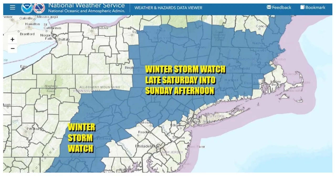
Winter Storm Watches have been issued in several areas, marking the first time in two years since the last winter storm watch was issued. The watches cover the Central Appalachians, Central Pennsylvania, Northeast Pennsylvania, Northwest New Jersey, the Hudson Valley, the Catskills, and extending eastwards to Connecticut, as well as Southern and Southeastern New England. However, the Connecticut coast south of I-95, Southern Rhode Island, and Southeast Massachusetts are exceptions to the watch. Furthermore, additional watches, warnings, and advisories will be issued on Friday. As for the weather conditions, there are no issues expected until the first part of Saturday, aside from some passing clouds overnight. Friday is expected to be a sunny day, albeit colder, with highs in the mid to upper 30s. By Saturday morning, temperatures will drop to the 20s to near 30. Throughout Saturday, there will be a transition from sunshine to arriving clouds, with high temperatures mainly in the 30s.
On Saturday, a low-pressure system will move up through the Carolinas and then head offshore. As a result, snow will spread northeastward through Pennsylvania and over Northern New Jersey, the Hudson Valley, NYC, Long Island, and points east into New England in the evening. However, along the immediate coast, rain is expected. On Sunday, as upper air energy transfers to the coast, the offshore low will strengthen. Models indicate that the intensifying offshore low will bring in colder air, resulting in snow continuing into Sunday afternoon. Although I am not completely convinced about this idea yet, I remain cautious about the potential snow accumulations.
If cold air becomes more significant, we may see the southern edge of accumulating snow shift southward into Central New Jersey and Long Island. It’s important to exercise caution and wait to see if this latest model development of a stronger and colder system materializes by Friday. If it does, we can anticipate increased accumulation numbers both inland and along the coast. The entire system will come to an end from west to east on Sunday afternoon. Weather conditions will improve on Monday, but another storm is expected to bring heavy rain, strong winds, and coastal flooding later on Tuesday into Wednesday. Inland areas may initially experience snow, and regions in Upstate NY and interior New England could receive a significant amount before transitioning to rain. We’ll provide more details on this storm once the first one has passed.
More News:
- The National Weather Service has issued a Winter Storm Warning for Upstate New York
- Phil Murphy’s decision to send refugees out of New Jersey show Democrats’ hypocrisy on the border
